The Essex Historical Society and Shipbuilding Museum (EHSSM), is a unique institution nestled along the…
COAST Analysis of Newburyport
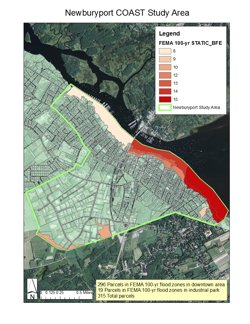
As part of the Great Marsh Resiliency Planning Project, COAST, a coastal adaptation and strategy tool, was run by GEI Consultants, Inc. in the City of Newburyport. Task Force members identified the most vulnerable downtown area along the Merrimack River and a chronically flooded area along the city boundary with Newbury as the study area. Using the city’s assessor data for building and land values, the analysis applied three sea level rise scenarios recommended by project partner MA Office of Coastal Zone Management. The final report summarizes future building damage from storm surge and sea level rise, including identification of any buildings completely lost to sea level rise. The COAST tool can help a community evaluate the costs of a “no action” scenario and will help guide adaptation planning as well as action and implementation.
Related Posts


This Post Has 0 Comments