The Essex Historical Society and Shipbuilding Museum (EHSSM), is a unique institution nestled along the…
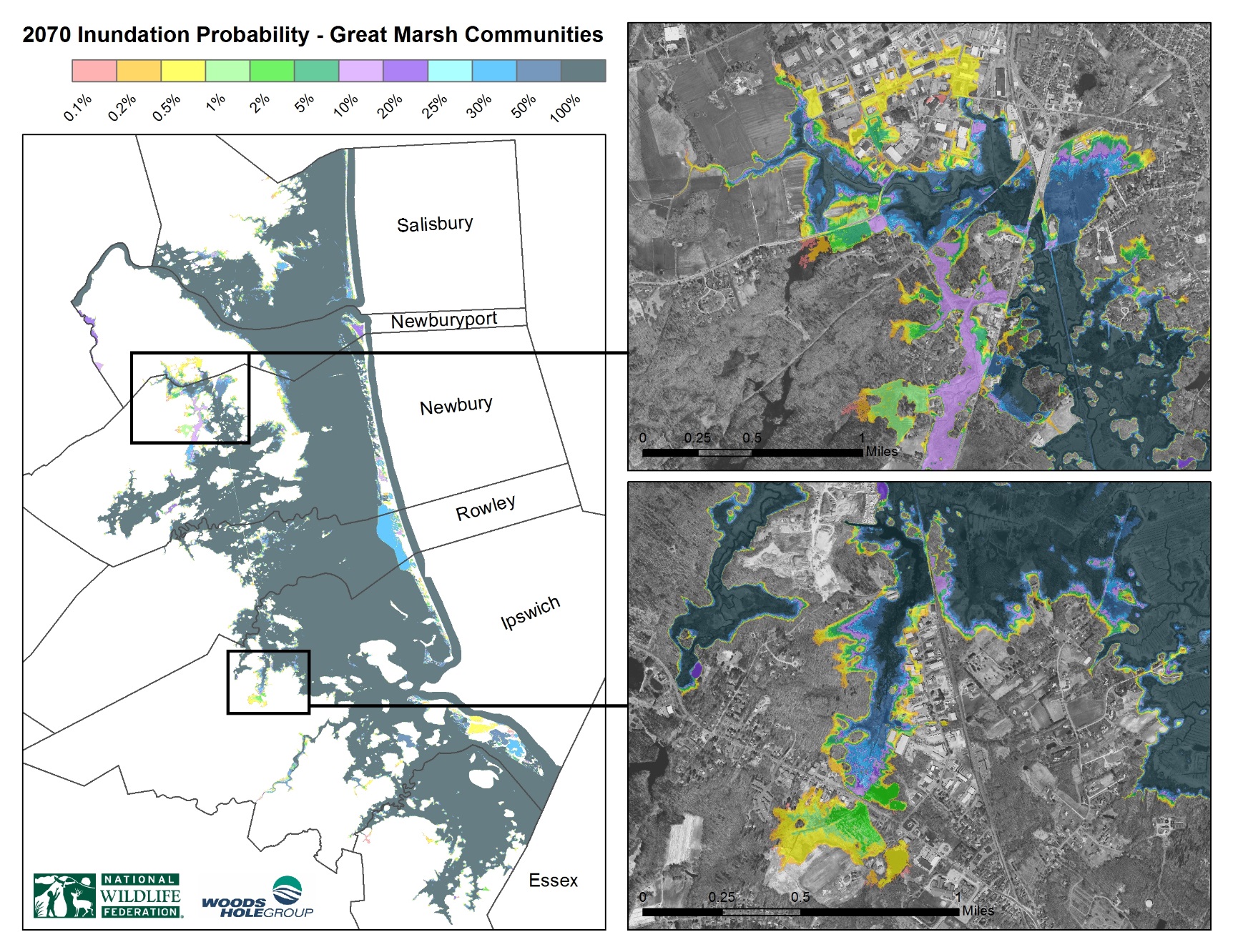
New Flooding and Sea Level Rise Maps Aid Resiliency Planning Efforts
New maps produced by the environmental consulting firm Woods Hole Group will provide the Great Marsh Resiliency Planning project with cutting edge, fine-scaled flooding and sea level rise scenarios in Essex County. The model, which uses data from Mass Department of Transportation, looks at the probability of every flood scenario occurring based on different levels of sea level rise. Using a statistical analysis, they analyzed thousands of real and projected storms. Woods Hole Group piloted this model for the city of Boston and the same map products were used in Gloucester’s 2015 Coastal Climate Change Vulnerability Assessment and Adaptation Plan. The Great Marsh region of Essex County will be the second pilot region to receive such detailed, fine-scale mapping.
Related Posts


This Post Has 0 Comments