The Essex Historical Society and Shipbuilding Museum (EHSSM), is a unique institution nestled along the…
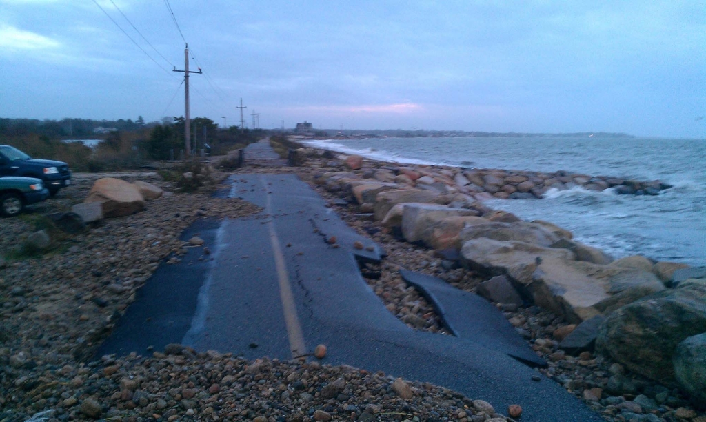
MyCoast Tracks Coastal Storms
At the Great Marsh Symposium held in Essex in November, Massachusetts Office of Coastal Zone Management staff unveiled MyCoast: Massachusetts, a portal to collect and analyze pictures and data relating to coastal storms. By accessing the website or downloading the MyCoast App to a phone, the public is invited to take photographs of coastal weather events, (either a King Tide or infrastructure damage from a storm), and upload it to the site, which will automatically determine the location, weather, and tidal conditions. Information collected is used to visualize the impact of coastal hazards and to enhance awareness among decision-makers and stakeholders. Check it out and help us document history this winter!
Related Posts


This Post Has 0 Comments